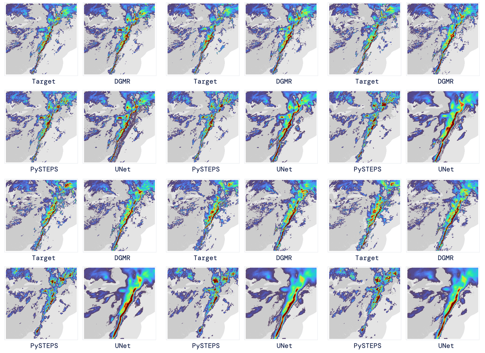
First protein folding, now weather forecasting: London-based AI firm DeepMind is continuing its run applying deep learning to hard science problems. Working with the Met Office, the UK’s national weather service, DeepMind has developed a deep-learning tool called DGMR that can accurately predict the likelihood of rain in the next 90 minutes—one of weather forecasting’s toughest challenges.
In a blind comparison with existing tools, several dozen experts judged DGMR’s forecasts to be the best across a range of factors—including its predictions of the location, extent, movement, and intensity of the rain—89% of the time. The results were published in a Nature paper today.
DeepMind’s new tool is no AlphaFold, which cracked open a key problem in biology that scientists had been struggling with for decades. Yet even a small improvement in forecasting matters.
Forecasting rain, especially heavy rain, is crucial for a lot of industries, from outdoor events to aviation to emergency services. But doing it well is hard. Figuring out how much water is in the sky, and when and where it’s going to fall, depends on a number of weather processes, such as changes in temperature, cloud formation, and wind. All these factors are complex enough by themselves, but they’re even more complex when taken together.
The best existing forecasting techniques use massive computer simulations of atmospheric physics. These work well for longer-term forecasting but are less good at predicting what’s going to happen in the next hour or so, known as nowcasting. Previous deep-learning techniques have been developed, but these typically do well at one thing, such as predicting location, at the expense of something else, such as predicting intensity.

DEEPMIND
“The nowcasting of precipitation remains a substantial challenge for meteorologists,” says Greg Carbin, chief of forecast operations at the NOAA Weather Prediction Center in the US, who was not involved in the work.
The DeepMind team trained their AI on radar data. Many countries release frequent snapshots throughout the day of radar measurements that track the formation and movement of clouds. In the UK, for example, a new reading is released every five minutes. Putting these snapshots together provides an up-to-date stop-motion video that shows how rain patterns are moving across a country, similar to the forecast visuals you see on TV.


